

Moorooka, QLD 4105
A family buyer’s guide to the Beaudesert Road shops, the forest streets and the rail works affecting the commute.
Brisbane suburb guide · Updated 20 November 2026
What families like about Moorooka
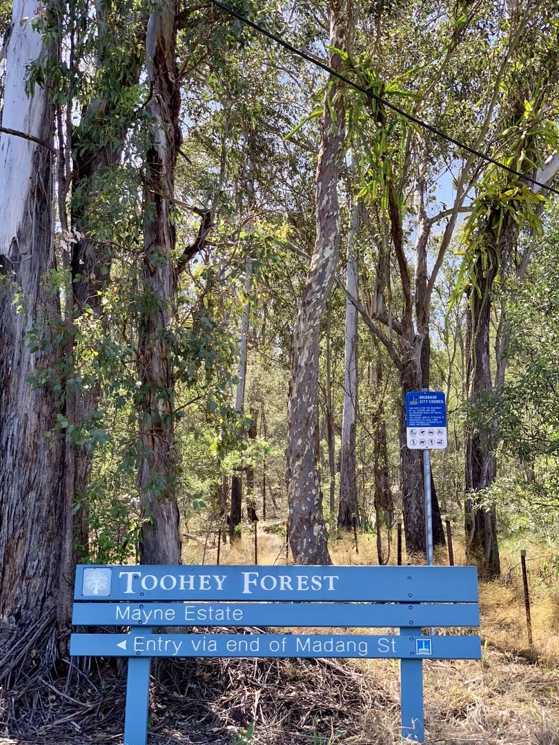
Moorooka gives families two quite different Saturday mornings. Along Beaudesert Road you can buy groceries and sit down for Ethiopian food. Toward Mayfield Road, Toohey Forest offers a bush walk before lunch. When comparing two houses, choose the outing you expect to do most often and try it on foot. A shaded street that looks close to the forest on a map may still be a long walk home with a tired child.
The distinction between Beaudesert Road and Ipswich Road is especially important for commuters. Beaudesert Road serves the shopping strip. The railway station is beside Ipswich Road and is closed for an accessibility rebuild. A listing that mentions both the shops and the station can describe two separate journeys. Walk the supermarket trip and time the bus trip before deciding what the location is worth to you.
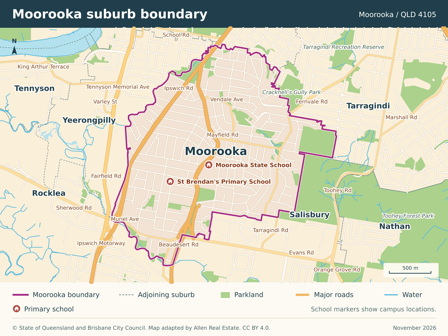
Where the suburb boundary runs
The purple line marks the official Moorooka locality, an area of about 4.07 km². Check the school intake area separately for each address.
Schools and the school run
| School | Location | Sector |
|---|---|---|
| Moorooka State School | 1 Sherley Street, Moorooka | Government primary |
| St Brendan’s Primary School | 17 Hawtree Street, Moorooka | Catholic primary |
Moorooka State School and St Brendan’s have separate entry arrangements. For a state school, enter the street number and proposed year level in EdMap. For a secondary place, run a separate search. St Brendan’s takes applications directly. Check a school catchment.
Coffee, groceries and weekends
Woolworths is at the corner of Beaudesert Road and Durack Street. Along the same strip, Ethiopian Village at 15/147 Beaudesert Road is a place to sit down for lunch. For buyers comparing units near the shops, try bringing groceries home by the route you would actually use. Ethiopian Village.
Pegg’s Park is at 114 Vendale Avenue. For a longer walk, use Council’s Toohey Forest track map to choose an entrance and a circuit. The heritage-listed forest extends to Mayfield Road in Moorooka. Toohey Forest walking tracks.
The Clubhouse Moorooka, on the old bowls grounds at 76 Koala Road, hosts social bowls and community activities. If you are considering the neighbouring streets, visit during an event to see how parking and foot traffic change. The Clubhouse Moorooka.


Getting to work
Moorooka railway station closed on 2 March 2026 for rebuilding. As at November 2026, Translink expects it to reopen in late 2027. In the meantime, StationLink route 19 connects the area to Rocklea station and the Princess Alexandra Hospital busway station. Yeerongpilly and Rocklea are the nearby open rail stations. Check the working timetable and the walk to the temporary stop for the house you are considering. Moorooka station closure and alternatives · Station rebuilding and StationLink.
Who lives here and what they live in
The 2021 Census recorded 10,783 residents and 4,925 private dwellings in Moorooka. The median age was 36. Separate houses accounted for 60.5% of occupied private dwellings, while flats and apartments accounted for 23.8%. A house sale and a unit sale here serve quite different buying briefs. ABS Moorooka QuickStats.
What different budgets bought in Moorooka
The La Monte Street and Woodridge Street houses both had three bedrooms, one bathroom and 607 m² of land, yet they sold a week apart for prices $290,000 apart. Woodridge Street was advertised as an elevated 1930s home with a covered deck and mountain views. Even a close match on paper leaves condition, aspect, frontage and the usable yard to check in person.
| Moorooka address | Home | Sale date | Price |
|---|---|---|---|
| 56 Beckford Street | 3-bed house, 723 m² | 13 Nov 2026 | $1,020,000 |
| 20 La Monte Street | 3-bed house, 607 m² | 5 Nov 2026 | $1,060,000 |
| 7 Woodridge Street | 3-bed house, 607 m² | 12 Nov 2026 | $1,350,000 |
| 55 Delville Avenue | 3-bed house, 809 m² | 13 Nov 2026 | $1,375,000 |
Four selected sales with publicly reported prices, checked 20 November 2026. Each is an individual comparison.
What to check at a Moorooka inspection
For a house on a slope, walk from the living room to the lawn. Check where a pram, bins and bikes would go, and how rain drains around any lower-level rooms. Use the address to obtain a Council FloodWise report.
Near Beaudesert Road or Ipswich Road, revisit the home on a weekday. Listen from the garden and the main bedroom, try the access from both directions and check the safety of the crossing nearest your bus stop.
For a home near the railway works, check the latest construction notice and visit at the hours you expect to be home. Beside Toohey Forest, locate the public track entrance and check the property’s planning overlays before costing extensions or tree removal.
FloodWise Property Report · Brisbane City Plan online
Considering a home in Moorooka?
Send us the listing, your budget and what matters most to your family. We can help you compare recent sales and decide what you would pay for this particular home.